Reimagining West 72nd Street
A People-First Crosstown Corridor Connecting Central Park and Riverside Park
West 72nd Street is about a half mile long, situated between Central Park and Riverside Park. It’s home to 20,000 residents, hundreds of businesses, and is a destination for countless visitors and tourists. This short street includes one of the busiest subway stations in the system and a marquee public space at Verdi Square. It’s also an important east-west spine for bus riders, bike riders, and pedestrians of all kinds.
But the design of the street is out of scale and out of date, to the detriment of everyone who uses it.
It’s time to remake West 72nd Street as a place that centers the experience of those who live, work, and otherwise rely on this vibrant and vital crosstown corridor.
Want to take action? Click the link above to send a letter to elected officials and the DOT urging them to be bold in reimagining West 72nd Street. Want to learn more? Read on to see how a reimagined corridor could work and the many benefits it would bring.
Yesterday: Park Thoroughfare
19th Century Connector – What’s Old is New Again
The West 72nd Street of today was originally established by the Commissioners' Plan of 1811, which is responsible for the street grid we’ve all come to associate with Manhattan.
By the end of the 19th century, West 72nd Street had evolved into a “park thoroughfare” extending from Central Park to the west, past rows of elegant homes, toward the Hudson River and newly constructed Riverside Park. Access to the street was limited to residents and workers who had business on those blocks.
From the New York Times Streetscapes column:
“With its comfortably appointed dwellings, West 72nd Street was a major residential boulevard, connecting the carriage drives of Central Park with Riverside Drive...The entire street was under the supervision of the Department of Parks, which prohibited (non-local) business traffic and paid for special plantings along the sidewalks…Later, the automobile converted a genteel boulevard into an internal combustion highway.”

West 72nd Street. 1898. Looking west from beyond Columbus Avenue. (Image credit: J. Clarence Davies Street Views Scrapbook / Museum of the City of New York / X2012.61.36.7)
A lot has changed in the last 125 years, but there’s something both practical and poetic about this early version of the street. What if we once again considered West 72nd Street a connection between the green spaces of Riverside Park and Central Park and made it a tree-lined parkway for people?
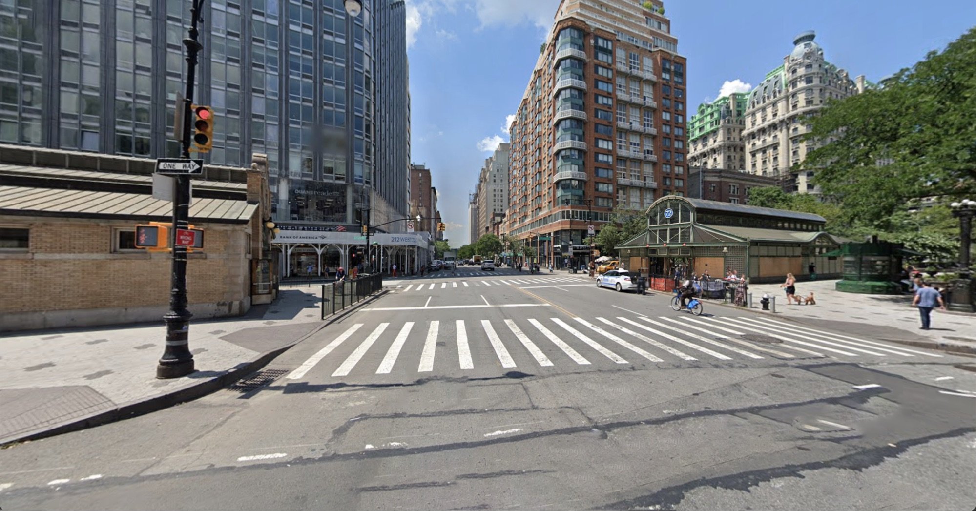
Today: Urban Arterial
20th Century Priorities – Wasted Space

There’s a lot of room here.
West 72nd Street’s park-connecting days vanished with the rise of 20th century motordom. Today the street is a vast four-lane arterial that is spatially inefficient, under-utilized as a transportation corridor, and under-realized as public space—an arrangement that doesn’t work particularly well for anyone.
The Street
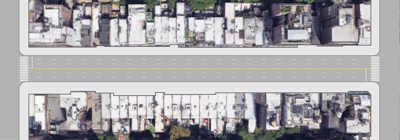
A survey of the roadway* along West 72nd Street reveals a disproportionate amount of space is devoted to motor vehicles, an arrangement that invites excess traffic and renders a large piece of public space inaccessible to anyone outside of an automobile.
*Curb uses were documented along each block from Central Park West to Riverside Drive; the results below reflect the entirety of this corridor. Street space was calculated by adding the vehicles travel lane area to the curb area to get an overall picture of the roadway.
Car use dominates the sixty-foot roadway, with 88% of that space devoted to vehicle lanes and parking. Take bus stops and no parking/no standing out of the mix, and it leaves less than 2% of street space for all the various other uses that could support people on these blocks.
The Curb
A similar condition can be observed at the curb, where parking is the dominant use despite private cars moving just one quarter of people along the corridor (more on this below).
40% of the parking on West 72nd Street is free at all times, and virtually all of the parking is free overnight—the original sin of present-day New York City curb use.
Setting aside bus stops and no parking/no standing zones, we’re left with less than 6% of curb space for all the other uses. We’ll explore below what those uses could be and they would benefits they would bring.
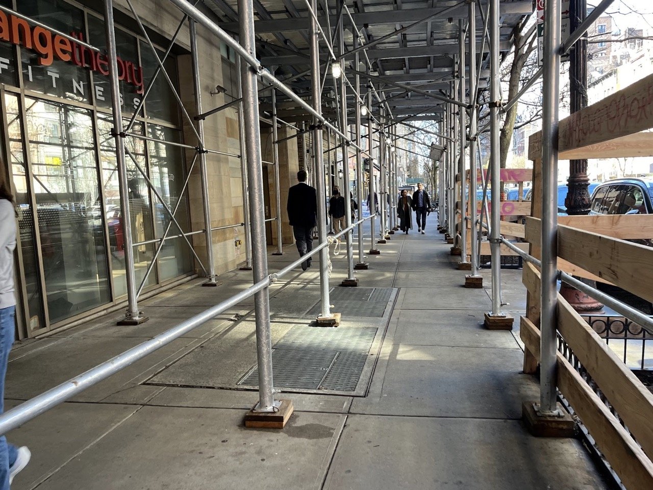
The Sidewalks
In terms of pedestrian space, the New York City Department of Transportation classifies West 72nd Street as a ‘Regional Corridor,’ defined as:
“Streets that have crowds of people passing each other, and a concentration of pedestrian destinations or large-scale attractions that draw people from around the region.”
This translates to a lot of people with not quite enough room to move, as everyone from residents to workers, day-trippers to tourists, squeeze into shared space that’s often too narrow, obstructed, or both.

This bike parking could be in the curb lane.
A maze of obstructions.
Counting Modes and People
In observations along each block of the corridor*, the numbers of people moving by foot, micromobility, and bus outnumbered those in motor vehicles by a margin of 3 to 1.
*Screenline movement counts were conducted over a two-hour period on a sunny Monday from late morning to early afternoon. Each mode that crossed at a given location was tallied—every person walking or riding a micromobility device, as well as each bus and motor vehicle. To estimate the number of people moved, pedestrians and micromobility devices were counted as one each, buses were assumed to carry 25 people each, and motor vehicles 1.25 people each.
People on Buses
Buses made up just 1% of movements we observed along the corridor, yet accounted for an estimated 22.5% of people, illustrating their extraordinary space efficiency—moving 9% more people than private cars in just one tenth of the space in our observations.
Community District 7 has some of the slowest bus speeds in the city, averaging just 6.34 mph, and West 72nd Street doesn’t have bus-priority lanes, which means bus riders are at the mercy of traffic congestion. Also, many of the bus stops along the corridor lack shelter, which can make taking the bus less practical and appealing.

Buses share travel lanes.

A meager bus stop with no shelter.
People on Bikes (and other small wheels)
West 72nd is used by people on various kinds of small wheeled devices—including tourists, recreational riders, working cyclists, and people just trying to get across town.
People on bikes and other micromobility made up nearly one tenth of the movements we observed and 7% of the people moving along the corridor—a significant number considering there is no dedicated space to travel safely.
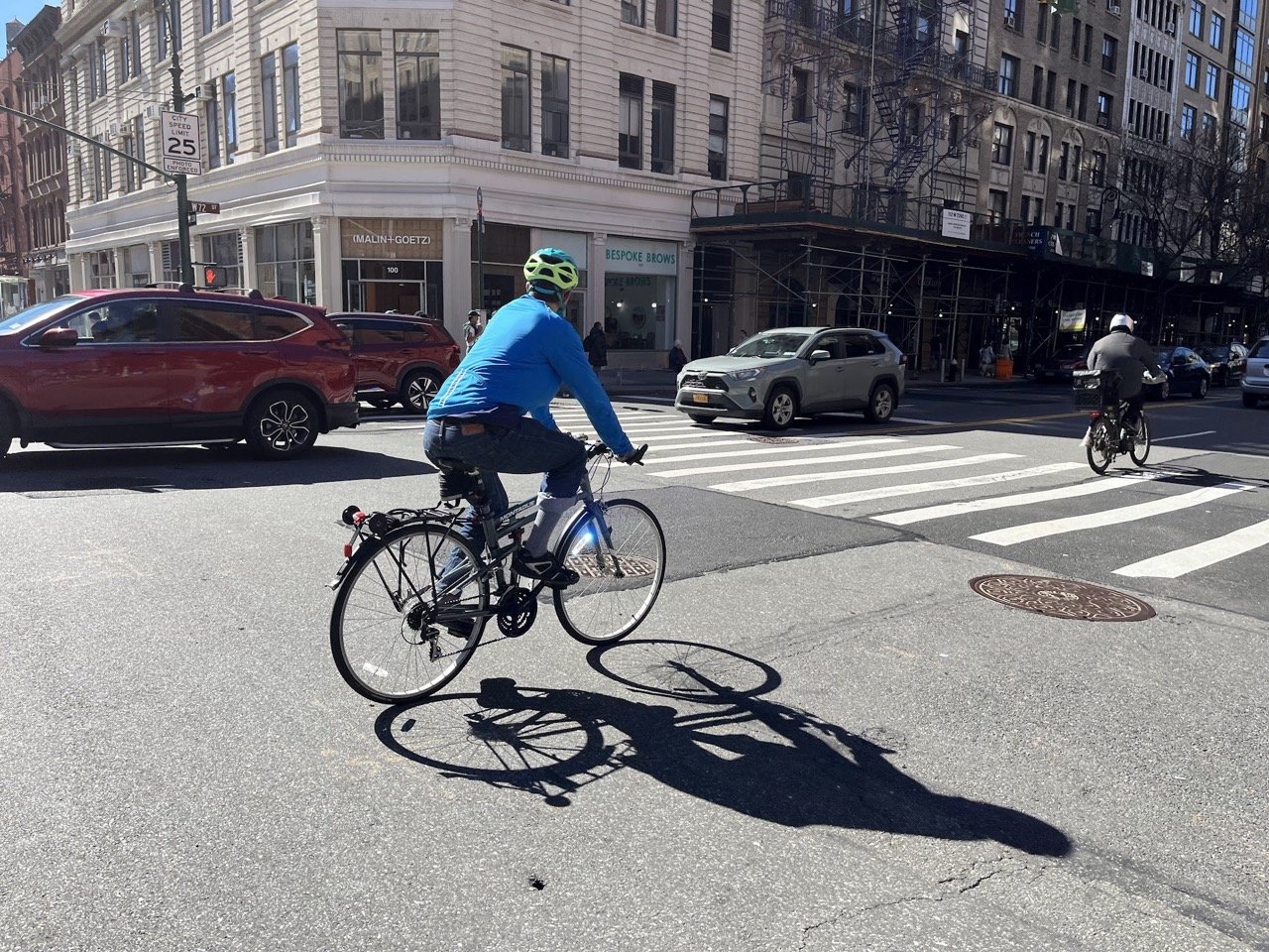
Claiming space among cars.
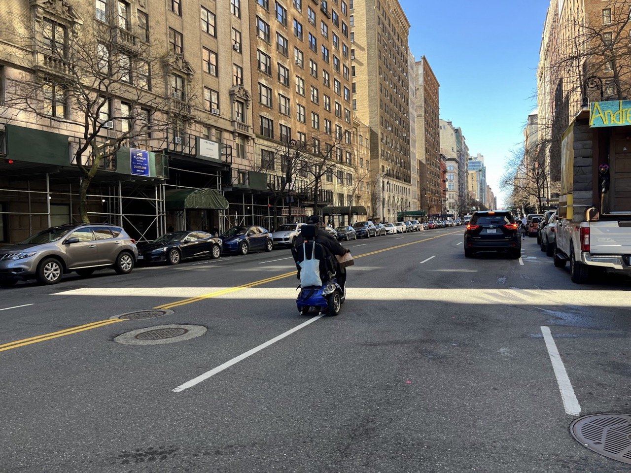
Using a mobility device in the street.
People on Foot
It’s often said of New Yorkers: we’re all pedestrians at some point in our journey, and that is abundantly true on West 72nd, where crowds of people spill in and out of the subway at Broadway, tourists gawk as they stroll between the parks, locals frequent businesses, and residents run errands or walk their dogs.
In our observations, people walking accounted for 62% of the movements and 45% of all people along the corridor. There are many reasons to walk or roll along West 72nd, and those doing it could use more space.

At the margins, cramped and crowded.
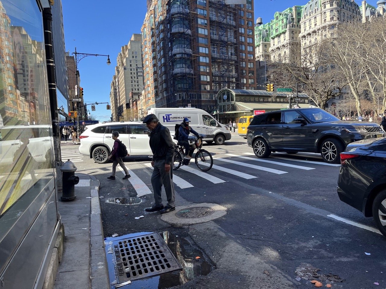
A typically uncomfortable crossing.
These more efficient modes of travel are already trying to claim space on West 72nd Street. What if we gave the people walking, riding bikes, and taking the bus the room they need to get around more safely, comfortably, and efficiently?
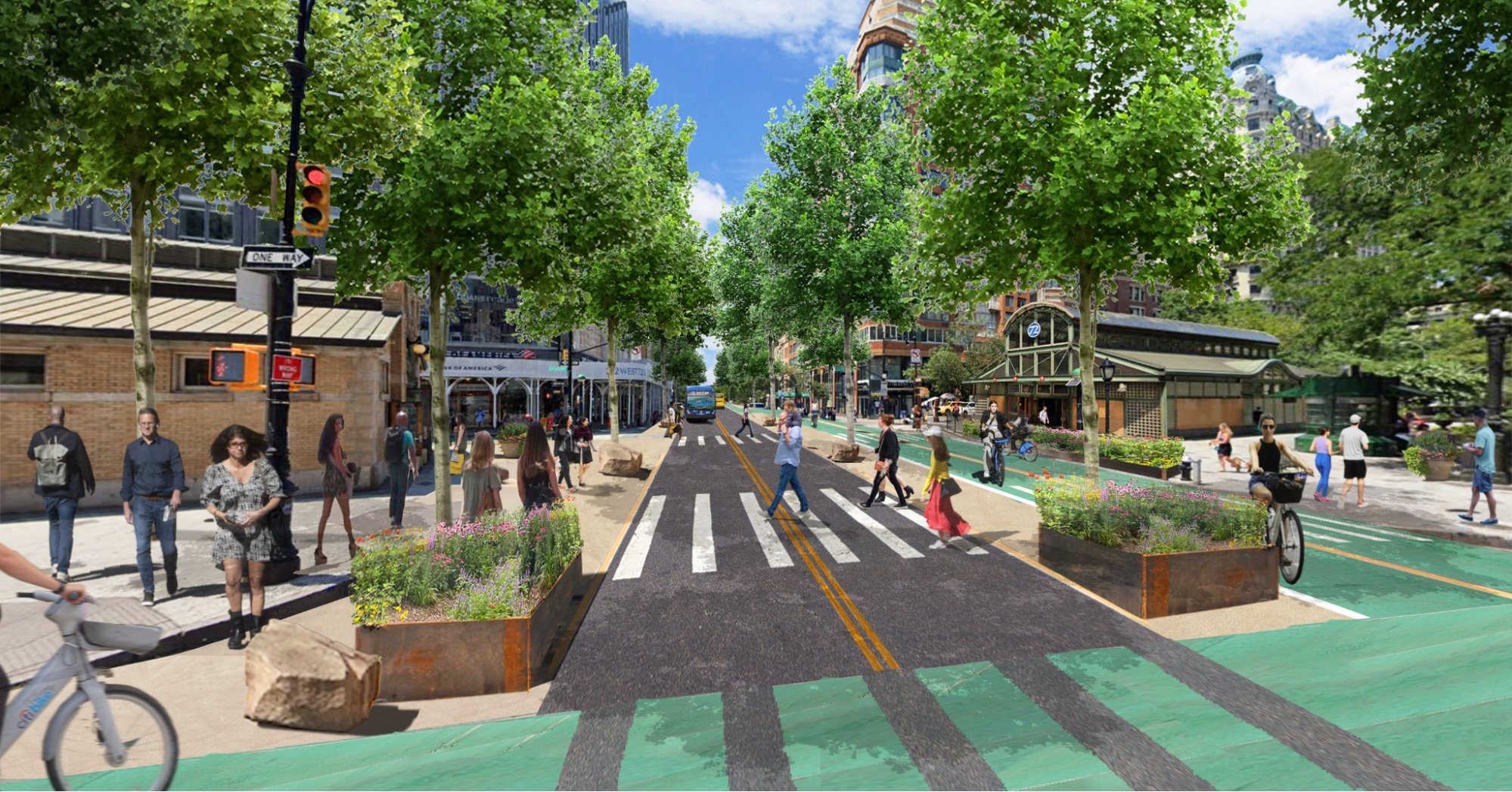
Tomorrow: Complete Street
21st Century Corridor – Prioritizing People
The need to rebalance the uses on West 72nd Street is nothing new. In fact, Community Board 7 passed a resolution in 2020 with overwhelming support, asking for a two-way protected bike lane along the corridor connecting the parks and including pedestrian safety improvements and loading zones:
“Community Board 7/Manhattan calls on the New York City Department of Transportation to present the board with a proposal for a physically protected two-way bike lane or lanes on West 72nd Street that would run between Central Park West and Riverside Drive or Boulevard and provide cyclists a safe connection to the Hudson River Greenway. The plan should also include infrastructure to protect pedestrians crossing 72nd Street and loading zones sufficient to meet the demand for deliveries to businesses and residences along the street.”
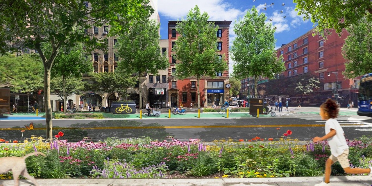
What would West 72nd Street look like if it better served everyone who uses the street?
People on buses might be given pride of place on the street and those in private cars considered guests. People on bikes might get the kind of high-comfort infrastructure that enables anyone, regardless of age or ability, to ride a bike for transportation. People walking and rolling might get to stroll a tree-lined street that’s comfortable to cross and a pleasant place to be.
A West 72nd Street “complete street” would:
Connect two iconic parks that collectively receive over 50 million visitors each year.
Calm traffic, reduce noise, and clean the air for residents along the corridor.
Make it safer and more comfortable for pedestrians to get around.
Act as a vital east-west spine in an eventual comprehensive cycling network.
Help businesses by moving people, goods, and services more efficiently in limited street space.
Plus, with lots of trees and rain gardens, the birds, butterflies, and bees would love it.
Here’s what that could look like:
From grayway to greenway
Making it Fit
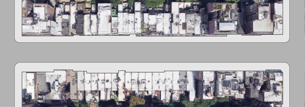
How might the pieces of this puzzle fit together? Let’s look at the block between Columbus and Amsterdam as a case study.
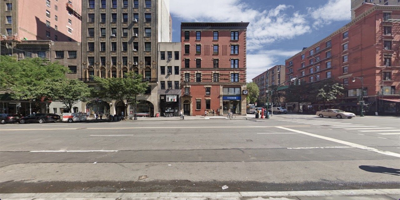
What’s There Now
Here’s the current configuration of the street: four lanes for vehicular traffic (shared by buses and bikes and frequent double parking), two curb lanes (used primarily for parking), with sidewalks on either side.
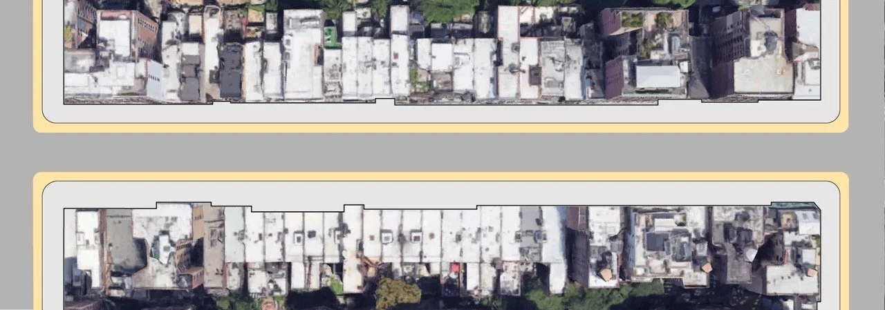
Sidewalks
Let’s keep the sidewalks but wipe the rest clean and start fresh. This gives us a 60-foot wide canvas for meeting the needs of the many people who use the street.
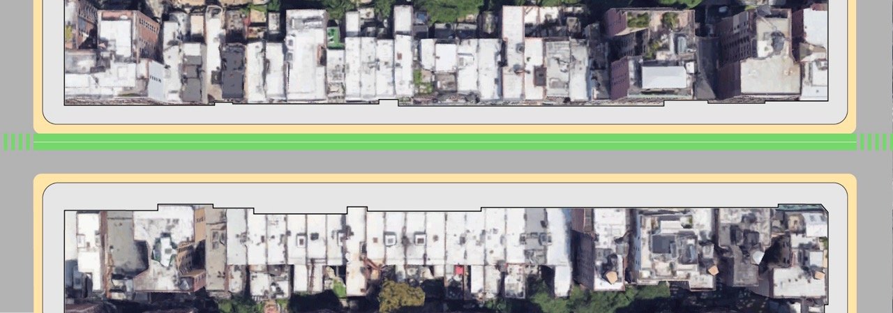
Curb lane
Now let’s put back that curb lane and consider it space for all sorts of things, not just parking. We’ll look at the details of these uses in the next section.
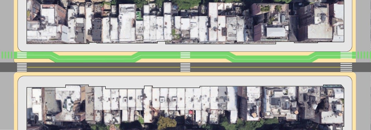
Cycle Track
Let’s add a generous two-way cycle track—wide enough for social cycling, delivery bikes, and people who might need a little more space around them, like kids or older adults.

Bus-Priority Vehicle Lanes
Now let’s put back two of the vehicle lanes and reserve them for buses and local access, not through-traffic. Don’t worry: things like local deliveries and access by car would be easy. Driving from one end to the other wouldn’t be allowed.
Staggered Curb Lane
Since a straight bike lane would cut off curb uses from the west-bound traffic lane, let’s introduce a gentle meander to the path, which allows curb uses to be distributed where they’re needed and slows speeds on the bikeway at the same time.
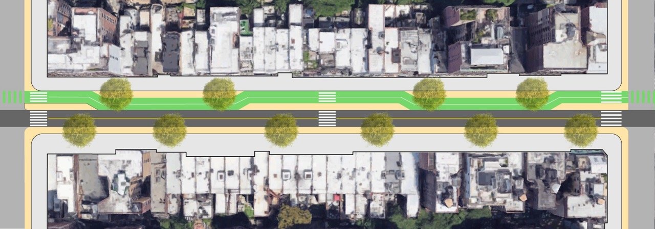
Trees
With those critical pieces in place, let’s not forget to plant lots of trees.
Making it Functional
Now, let’s look at some of the different uses that might improve the experience of people along the corridor. Below are some examples that would serve a variety of needs, like safety, accessibility, convenience, and cleanliness, among others.

All of these uses are included in the NYC Department of Transportation’s ‘Curb Management Action Plan’, which is currently being piloted in an area of the Upper West Side that includes the two easternmost blocks of West 72nd Street.
Some of the public feedback received during DOT’s pilot outreach describes the conditions experienced by street users. For instance:
At Columbus:
“Crossing distance is very long in both directions. Cars tend to come fast along 72nd.”
“Would be nice to have green space where we could sit here.”
At Amsterdam:
“This crossing is very dangerous...The number of pedestrians at this intersection far outweighs cars, but most of the space is given to private vehicles.”
“Need a bus stop on the SE corner. It is too hard for seniors to cross to SW side of W 72 and Broadway, and too far to walk over to W 72 and Columbus.”
At Broadway:
“Very crowded intersection near 1/2/3 subway line.”
“Pedestrian crossing lights don't give people enough time to cross Broadway to Amsterdam on W 72nd St. Always a backup and drivers often in the intersection stopping pedestrians from crossing.”
On the whole block:
“W72nd needs a two-way protected bike lane in both directions connecting the Hudson greenway to Central Park.”
“Secure bike parking is needed in front of all residential buildings.”
Those are some of the issues people identified. Explore some of the potential solutions below by clicking on the + to read more.
Cycle Track
A cycle track is more than a bike lane. It’s high-comfort infrastructure designed to be usable by people of all ages and abilities. Purpose-built, inclusive cycling infrastructure encourages micromobility use by providing safe passage for everyone from working cyclists and tourists, to school kids, seniors, and everyday commuters.
In fact...
Protected bike lanes are proven to make streets safer for all road users. On Prospect Park West, in Brooklyn, sidewalk riding was reduced from 46% to just 3% after the protected bike lane was installed.
Did you know?
There are more than 610,000 cycling trips made across New York City on a typical day, a number that has been growing year over year for the past fifteen years.
Mid-block Crosswalks
It’s already common to see people crossing mid-block on West 72nd; providing a proper mid-block crosswalk would increase safety, especially for those needing a little more time to get around. It would also help knit the corridor together by allowing for a more cohesive pedestrian experience, making visiting businesses, meeting neighbors, and enjoying public space as easy as strolling down the (tree-lined) street.
In fact...
Mid-block crossings are shown to improve safety, and are particularly helpful for older adults or those with mobility challenges.
Did you know?
There are already examples of mid-block crossings on the Upper West Side, like those on Columbus between 97th and 100th Streets and on West 106th Street between Columbus and Amsterdam.
Citi Bike Station
Bike share is a convenient, clean, low-cost transportation option that can supplement public transit and replace car trips. Having stations conveniently located also helps local businesses by attracting customers.
In fact...
A 2018 NYU study showed that restaurants closer to bike share stations do more business than those farther away. And a 2013 City University study showed a 52% increase in commercial spending near where bike share stations were installed.
Did you know?
The Citi Bike station at Columbus Ave and West 72nd St is the most used station on UWS.
Dynamic Metered Parking
Pricing parking to meet demand ensures the minority of customers who arrive at businesses by car will be able to find parking nearby, even while the remaining curb space is reallocated to other users and uses.
In fact...
A City of Boston pilot found that dynamically priced parking meters led to more available parking spots, less double parking, fewer parking violations, and safer streets.
Did you know?
According to a Harvard study, the value of a parking space on the UWS is between $7,000–$8,400 per year.
Passenger Pickup & Drop-off Zones
Too often passengers using for hire vehicles or paratransit are left off in the street, having to navigate between parked cars to the safety of the sidewalk. Dedicated space pickup and drop-off zones make getting in and out of a ride quick, easy, and safe.
Street Trees
Tree cover reduces the urban heat island effect, beautifies the streetscape, and encourages social and economic activity by making the street a comfortable place to be. It would also act as natural wayfinding between the green spaces of Central Park and Riverside Park.
In fact...
The urban heat island effect makes hot summer days feel between 8 and 12 degrees warmer in areas of the Upper West Side, depending, in part, on shade from trees.
Did you know?
Trees are a heat mitigation strategy to fight the effects of climate change. Following up on the successful MillionTreesNYC project, all five NYC Borough Presidents support an effort to reforest NYC with one million more trees by 2030.
Wider sidewalks
Expanding space for pedestrians, especially in areas where it is already pinched near transit stops and intersections, makes the corridor a safer and more pleasant place to be, increasing social and economic activity.
In fact...
The clear path on a given sidewalk is often much narrower than the sidewalk itself, increasing crowding and making it difficult for people pushing strollers or using mobility devices to access.
Did you know?
Expanded sidewalks are part of the DOT curb toolkit and have been implemented recently just south of the Upper West Side on Ninth Avenue in Chelsea.
Outdoor Dining
Outdoor dining is good for business, and it’s good for street life, creating interest and vitality on the street. Following several years of the emergency program, new design standards from DOT will be in place this year, making for a more cohesive streetscape and a better experience for everyone.
Bus Priority Lanes
A bus priority corridor—similar to 14th Street— would not only help bus riders get where they’re going more quickly; it would incentivize people to use mass transit, reduce air and noise pollution along the corridor, and make the streets safer for all users.
In fact...
On 14th Street in Manhattan, crashes have decreased by more than half since the busway was installed, and bus speeds have increased 24% and ridership 30%, while traffic on adjacent streets has seen virtually no change, despite predicted gridlock.
Did you know?
There are nearly 4 million annual riders on bus lines that run along all or part of W72 street.
Fast Micromobility Lanes
Because bus-priority lanes reduce traffic volume, and buses pass only every 6 minutes or so, riders of electric and gas powered mopeds could share these lanes, giving them a safe place to ride that is out of the bike lanes and off the sidewalks.
Secure Bike Parking
Making it convenient and easy to leave a bike at your destination helps businesses and incentivizes cycling as a mode of transport, making cycling more viable to more people, creating a virtuous cycle.
In fact...
Access to secure bike parking is one of the main factors in whether people choose to ride a bicycle for transportation.
Did you know?
Innovative local companies like Oonee are developing scalable, secure bike parking solutions right here in NYC. In some countries, ample secure bike parking is clustered around transit stations to facilitate seamless transfer between modes.
Loading Zones
Dedicated loading zones for freight and parcel delivery allow delivery workers a predictable place to unload without putting others at risk by double-parking. Spaces could be reservable by delivery companies for set time periods, ensuring fairly priced and efficient use of the space.
Trash Containers
Getting trash into containers means less trash on the sidewalk, fewer rats, and a tidier streetscape. It also affords more sidewalk space to pedestrians, increasing comfort and encouraging strolling, shopping and just hanging out.
In fact...
A curbside containerization pilot in West Harlem has been so successful it’s been expanded to include schools on the Upper West Side.
Did you know?
European-style curbside bins are coming to New York City.
Bioswales
Also known as rain gardens, bioswales beautify the block while also holding stormwater runoff during heavy rain events, which prevents localized flooding and reduces combined sewer overflows into local bodies of water (e.g. the Hudson River).
In fact...
A single rain garden can manage up to 2,500 gallons of rainwater during a storm and hold that water for up to two days.
Did you know?
More than 70% of New York City’s surface area is impervious, and nearly 1/3 of that impervious area is street space.
Street Seating
Street seating allows people to stop and rest, which is especially important for folks who might take a little longer to get around, like older adults, pregnant people, families with small kids, and people with disabilities. Paired with street trees, a place to sit also makes the street more inviting.
Bus Shelters
No one wants to wait for the bus in the rain or blazing sun, especially as climate change makes these phenomena more intense. Integrating bus shelters into complimentary curb uses improves the appeal of transit and makes the experience better for those who rely on it.
Reimagining the curb as a flexible space with multiple uses can be difficult in the abstract. But looking at the potential uses and who would benefit makes clear it’s not so much about losing parking as it is gaining a whole host of things that would benefit everyone using West 72nd Street.
What’s Next?
How You Can Help
How do we turn a reimagined West 72nd Street into reality?
You’ve read this far, that’s a great start! The next thing you can do is sign the petition below and send a letter to your local elected officials and the DOT to register your support for a reimagining of this corridor that puts people’s needs and experience at the center.
What we’ve laid out above is not prescriptive—in the end, the details of a future West 72nd complete street may look a little different. But we believe a few core ideas should guide any plan:
Connect Central Park and Riverside Park for pedestrians and cyclists.
Reduce the current four vehicle travel lanes to two, limit through-traffic, and give buses priority.
Include a world-class, high-comfort, all ages and abilities cycle track.
Expand sidewalks and shorten crossing distances at every intersection.
Add mid-block crosswalks on every block.
Repurpose the curb lane to serve multiple uses in proportion to needs.
Plant a lot of trees.
If you’re inspired by this vision, please support it by clicking below to send a letter to elected officials and the DOT. We’ll also keep you updated on the campaign and tell you about more ways to help and get involved. Together, we can make it happen.
